 English

 New goods
Арбет Мрамор / Arbet Marble / Map of Russia by Gessel Gerrits, Amsterdam, 1614 in a baguette - a replica

- Supplier
- Arbet Marble Ltd.
Description
"Map of Russia" with engravings by Gessel of Gerritse (Amsterdam, 1614), published by Willem Blaeu in 1630-ies of the original, which, as the inscription on the cartouche, "to be attended to Fedor, the son of Tsar Boris", extended to the rivers Dvina and Sukhona and other places, as far as possible this was done on the basis of the extant maps and news, and was dedicated by Gessel Gerard, the Great Emperor, Tsar and Grand Prince of all Russian Mikhail Fedorovich, Autocrat Vladimir, Moscow and Novgorod, Tsar of Kazan, Tsar of Astrakhan, Tsar of Siberian, Sovereign Pskov, Grand Duke of Smolensk, Tver, Yugra, Perm, Vyatka, Bulgaria, etc., The sovereign and Great Prince of Novgorod Nizovsky lands, etc., The Emperor of the lands of Iberia, king of Kartli and Georgian. 1614 year. This map is of great interest to researchers and not passing disputes of historians. In the lower left corner we see that the map refers to the period of the reign of Tsar Mikhail Fedorovich. Date 1614 confirms that this is the first year of the Romanov dynasty, who rise to the throne in 1613. In the upper left corner on the sidebar with a map of Moscow referred to Tsar Fyodor Borisovich (1589 - 1605) was the son of Boris Godunov, who ruled from 13 April to 1 June 1605. After the murder of the young king begins the struggle for the throne which ends in 1613. Between 1605 and 1613 for nearly a decade. If the card was ordered in the year of the reign of Tsar Boris, it has acquired border 1613 - 14, and was released much later, in 15 - 20 years. On the map, in the upper left corner, are the capital Moscow Russia, incredible for those times the fortress city. In the right part of the map clearly visible boundary separating Muscovy from another state Tartary, to retreat beyond the Urals under the pressure of the Romanovs, however, not surrendered to the Romanovs and they at that time did not belong. The only city Tartary, marked on the map - Tobolsk, designated as the capital of Siberia. But it was not the state of Sibir, was Tartary, Tobolsk and became its new capital. The political correctness of the compilers of the map in relation to the new Royal dynasty brings a smile. What happened to the Siberian city? Or in addition to the Tobolsk they simply did not exist? And what a formidable force near Tobolsk is a huge military connection "Piebald Horde"? Note the name of the river Volga Wolga olim Rha - Volga, before RA (lat.). Let's think, where in the name of Russian river came from the name "ancient Egyptian" Sun God. The developers of the theory of the New Chronology by A. Fomenko and G. V. nosovskiy in his books give a clue to this phenomenon. They also write that the true Israel is the territory of Russia. In this case, everything falls into place: Israel - From RA, that is, the people or the country from the valley of the Volga river, where, as you know, was built all the ancient Russian capital, Yaroslavl, Rostov, Suzdal and etc, made in favor of a new Royal dynasty, confirms the fact that Tartary at that time occupied a major part of the Russian Empire. Above the cartouche pasted the following text from the author of the prints: "Tomasz Makowski on his map of Lithuania has placed Kiev latitude 50° 10', Cherkasy - 49° and Ochakov to the South for a distance of 67 miles from Cherkasy. Card also served during the preparation of this map, put the city Borisovna, Azov, and, probably, Astrakhan, in the latitude of 48°, but, as on the one and on the other, the Northern area shows a high to the North, I also not dared to trust to the localities located in the South, impelled mainly their wrong position relative to Constantinople. However, I think you can southern area to apply a little below, because the English writing that they have found in Astrakhan latitude 46° 10'". This text confirms that if was the basis of the map Fyodor Borisovich Godunov, it was substantially rebuilt later. It also shows that the place names in times of turmoil rather freely "wandering" on the map and was finally established much later. This card was considered good fortune. One collector's house burned down and was left untouched by fire and only map of Russia in 1614 and a couple of books. The merchant Egor Melnikov after the acquisition of the same cards won a major prize in a lottery. Your winnings it is linked with the purchasing card. Melnikov ordered a copy of your card and gave it to his brother. And bizarre coincidence: brother merchant has agreed to the entreaties of Egor and for the first time in my life bought a lottery ticket. This lottery ticket has brought its owner a fortune.
Characteristics
- Package height, mm
- 0
- Length in packing, mm
- 0
- vendor code
- Package weight, kg
- 0
- Width in packing, mm
- 0
Similar products


Арбет Мрамор / Arbet Marble / Large baguette map of the world, Amsterdam, 1683 - replica
- Vendor code
- 37265
Price 338.49 USD


Арбет Мрамор / Arbet Marble / Map of Russia by Hessel Gerrits, Amsterdam, 1614 - replica
- Vendor code
- 37266
Price 33.85 USD
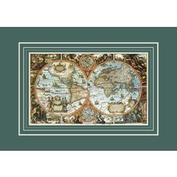

Арбет Мрамор / Arbet Marble / Large world map, Amsterdam, 1683 - replica
- Vendor code
- 37264
Price 62.36 USD


Арбет Мрамор / Arbet Marble / Set of replicas of old cards without baguette
- Vendor code
- 29768
Price 151.43 USD

Арбет Мрамор / Arbet Mramor / "New Map of the Whole Empire of Great Russia", Amsterdam, 1730 - replica
- Vendor code
- 37274
Price 33.85 USD


Арбет Мрамор / Arbet Mramor / Map "Moscow, the capital city of the whole White Russia", Cologne, 1610 - replica
- Vendor code
- 37272
Price 33.85 USD